


Storm could be worse than predicted
Van Wert independent/EMA information
A significant winter storm is taking aim for the area and is projected to cripple much of the eastern half of the United States, said County Emergency Management Director Rick McCoy.
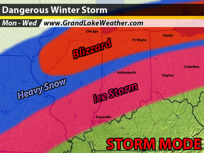
According to McCoy, computer models are coming into agreement that the storm now named the “Ground Hog Day Storm” will affect millions from Texas to New York, ranging from severe storms including tornadoes in the southern states to an ice storm and blizzard across the central plains to the Ohio Valley and northeast. “We are seeing some similarities to the storm of January 1 and 2 of 1999, when Van Wert saw 6 inches of snow followed by an inch of ice,” McCoy said.
Since Friday, forecasters have been trying to predict the exact path – knowing that the storm would be inevitable – but trying to pinpoint the types of precipitation of certain areas has been difficult.
As the storm continues to evolve, more indications point to blizzard conditions with one to two feet of snow across northwest Indiana and northern Illinois.
“Back here in Van Wert County, it is now looking like an ice event, which is certainly not what we want,” said the EMA director.
As of Sunday morning, McCoy said it appears that a disturbance will move through Monday night, dropping as much as 3 inches of snow across the area. Then on Tuesday, the big storm will approach, likely beginning as snow across the area and possibly dumping an additional 3 inches in the evening.
Then after midnight Monday, a shallow warm layer of air will move over the top of the cold air and freezing rain will begin and continue all night. The saving grace, McCoy said, is that sleet could mix in with the freezing rain bringing ice accumulation totals down. If the sleet doesn’t develop, McCoy said, accumulations would likely exceed a half-inch of ice. Then on Wednesday, precipitation will change back to snow, with another 3 inches possible.
Winds during the event will blow at 25 to 35 mph, with higher gusts expected.
“Every scenario you look at with this storm is bad,” McCoy said. “If we remain with all snow and the high winds, a blizzard would occur, but the worst-case scenario seems to be looking more likely with ice accumulations and strong winds.”
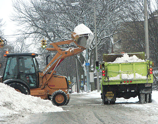
Ice storms and wind can spell power outages for an extended period of time, the EMA director added.
“I hope people have been preparing for this storm all weekend, no matter what the outcome is, and will be prepared to handle a major winter storm,” he said.
The National Weather Service will be making fine adjustments all day today as the storm approaches. The EMA office urges everyone to monitor Weather Service announcements and listen to local media for further updates.
Should the storm hit as predicted, announcements would be made at the top of the hour over WERT Radio in the event that shelters are opened or emergency announcements need to be relayed to the public. In the event of power outages, use a battery-powered transistor radio or go to a vehicle and turn on the radio at the top of the hour for important information.
One of the culprits for the winter storms this year is the current La Niña global weather system, McCoy explained. This weather phenomenon is the result of cooler than normal waters in the Equatorial Pacific that affects the global weather patterns. Indications are that it will continue to remain strong through February and beyond.
“In La Niña years, we see an increase of moisture during the winter months, but, fortunately for Ohio, most of the big storms that have developed moved across the Tennessee Valley and up the East Coast,” the EMA director said, adding that the upcoming storm, though, shows more potential because it appears as if it will affect many states and take aim at Ohio and Indiana.
“I know everyone is keeping their fingers crossed and hope that this one misses us, but we certainly need to be ready and take this storm very seriously,” McCoy said.
POSTED: 01/31/11 at 3:36 am. FILED UNDER: News